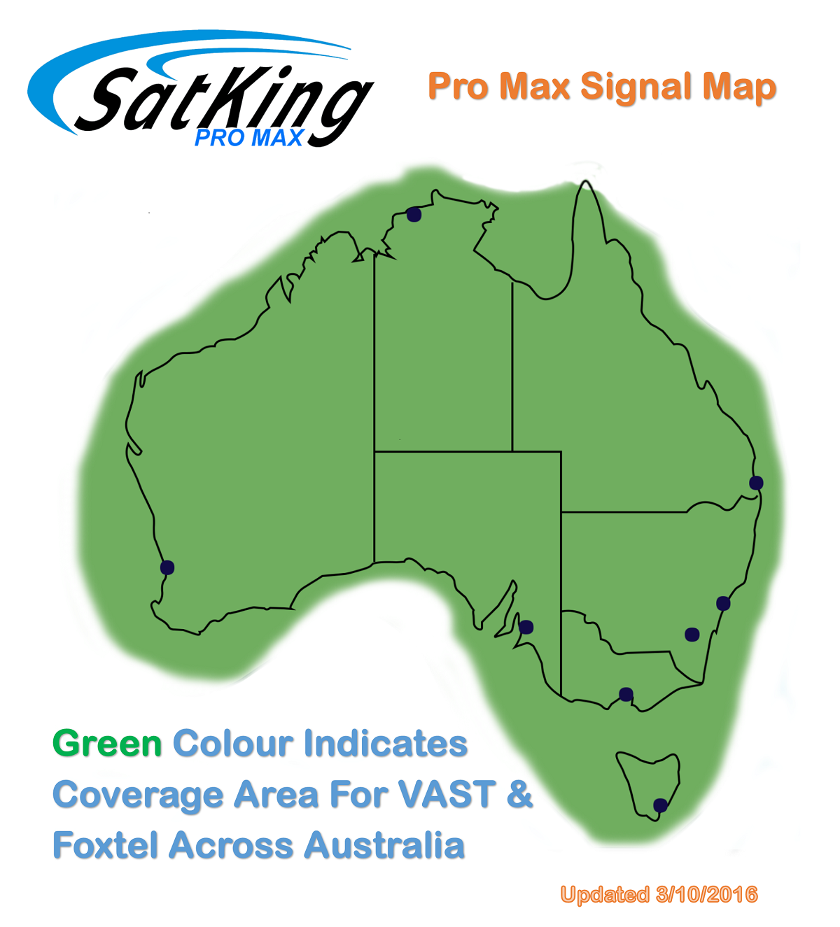
This map has been designed to let you know where you can receive both VAST Satellite TV and Foxtel Satellite TV around Australia with the Pro Max Automatic satellite system. The areas on this map in green are within the coverage area for the Pro Max, this is the majority of Australia. The area in white you should expect variable or no coverage. With any signal coverage map there can be some areas within this map with lower than expected signal levels, we have tried to assure accuracy within this map.
Satellite TV comes from satellites than are in a geostationary orbit (they don't move and are locked to the earth’s gravity) so they are always in the same position. In Australia the satellite TV signals from VAST and Foxtel services are spread across both Optus C1 & Optus D3 satellites. These two satellites co-exist in the same location. The satellite beams do vary across the two satellites and this is why in some locations one satellite could be stronger than the other. Satellite TV providers specially design the beam of the satellite to cover where the population lives or travels. Satellite TV signal is not effected by hills/terrain or distance from terrestrial transmitters like normal terrestrial TV (digital TV) as the signal comes from a satellite in the sky. Satellite signals can be effected by rain, heavy cloud, overhanging trees or by a building blocking the northern sky (the building would need to be very close to the system to block the signal). When a satellite signal drops out or can’t be received during a storm or heavy cloud normally you just need to wait until this weather event passes and then normal service should resume. If you are in a lower signal area a lesser rain or cloud event could block the signal, again just wait for the weather to improve for normal service to resume.